

Other Content
Quick links:
All images and site content are copyrighted to Philip Raggett unless stated otherwise; No form of reproduction or manipulation of these images is authorised.
Home | Accommodation | Car Hire | Restaurants | Safari Companies | Books | Photo Galleries | Charities | Reviews | Advertising | Contact
Safari News
Featured Charity


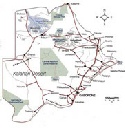
Map of Botswana


PALAPYE
Description and history
Palapye is a large village, in many ways like a small town, with 'suburbs' rapidly growing up. It originally served as a railway siding, and takes its name from the Impala antelope which was abundant in the area.
Location
Palapye is located in eastern Botswana, near the Lotsane river. It is the busiest intersection on the main Gaborone - Francistown road with a number of shops and petrol filling stations at the intersection between Palapye, the A1 Gaborone - Francistown highway and Serowe.

Home -> Towns & Cities -> Palapye
Interactive Map
Click on the place you want to navigate to
Population
Palapye has a population of 37,000 (2011 census). It has grown chiefly due to its location, and to a limited extent, due to the Morupule coal mine and power station, 5km to the east on the Palapye - Serowe road. This provides electricity to most of Botswana, and Palapye has become known as 'Botswana's powerhouse'.
Features
There is a railway station, several primary and secondary schools, banks, various shops and supermarkets, 2 post offices, a police station, several district offices, a hospital and numerous small industries.

